“Where do we start?”
The most important question with no fast answer. While the coordinator estimates the area by hand, every minute lowers the odds.
ASAR, a system for crisis, search and rescue coordination
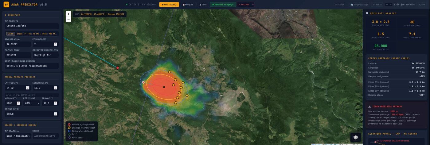
As head of the national 112 centre I saw the same problem in every crisis: the first questions are where do we start, who do we call and do we have an SOP, while time is running. ASAR gives the answers in minutes: prediction, a plan, drones and teams on one screen, with AI that suggests the next step. Everything that is decided stays in the system.
For 112 centres, civil protection, mountain rescue, MRCC, fire services, police and armed forces.
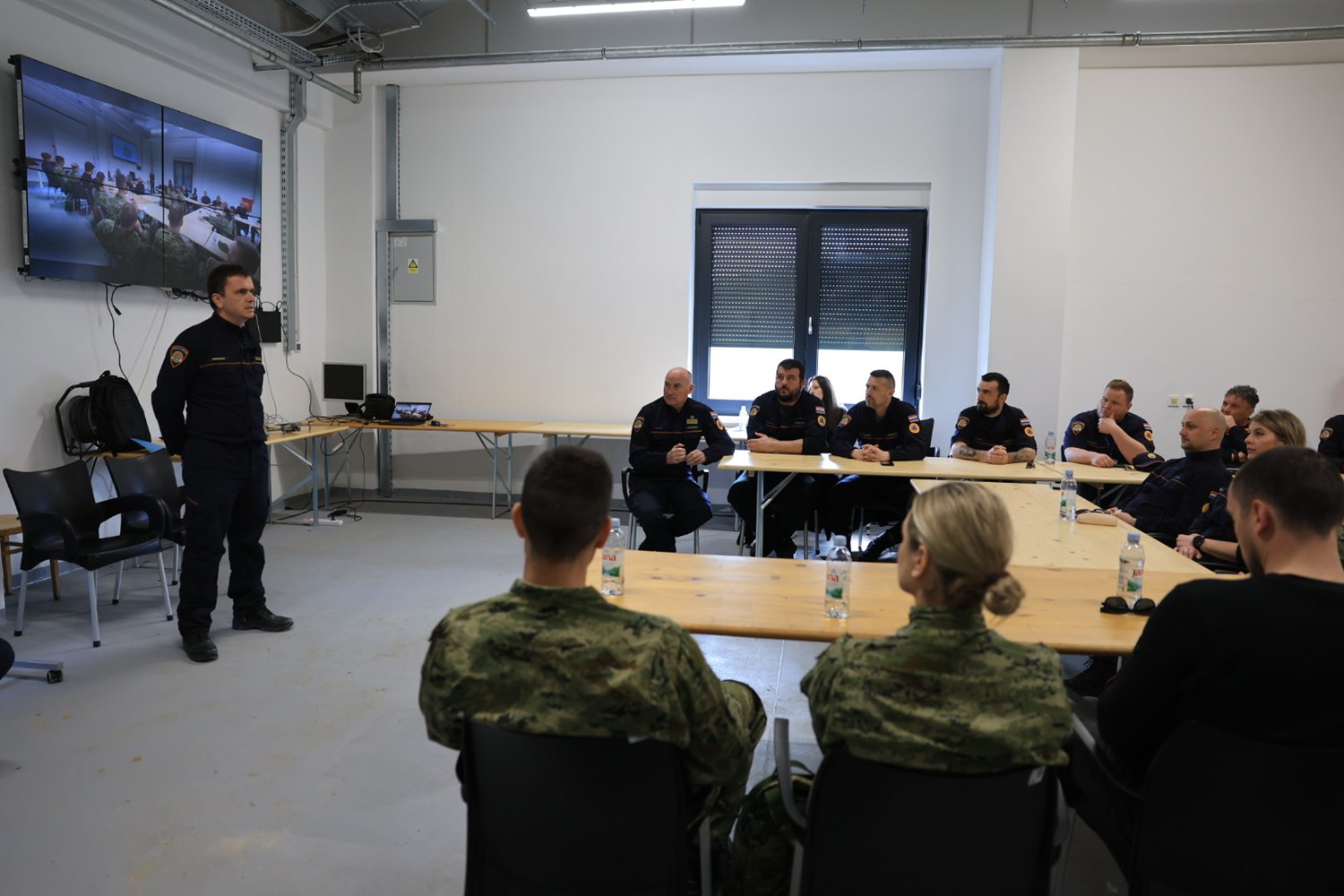
The SkyFlight app was part of the unmanned aircraft operations training programme of the Civil Protection Directorate, the Maritime Rescue Coordination Centre (MRCC) and the Croatian Armed Forces, Jastrebarsko, 31 March to 4 April 2025. Read the announcement
Not to act, but to decide where to start. Everything after that depends on that decision.
The most important question with no fast answer. While the coordinator estimates the area by hand, every minute lowers the odds.
Coordinates are spelled out over the phone, forms are filled in by hand, and information reaches the emergency services late.
Helicopters, boats, ground teams, drones and firefighters on different systems. Nobody sees the whole operation.
A coordinate copied from a phone call, a time written from memory. One mistake on a form sends teams to the wrong place, and later nobody can reconstruct it.
ASAR
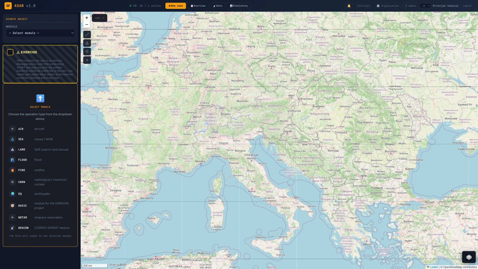
Each module covers prediction, planning and coordination for its type of crisis. All of them share satellite imagery, AI reports, the audit log and multi-organisation work on the same incident.
 AIR
Monte Carlo prediction of the crash site, RCC form, NOTAM zone, coordination with civil and military aviation authorities.
 SEA
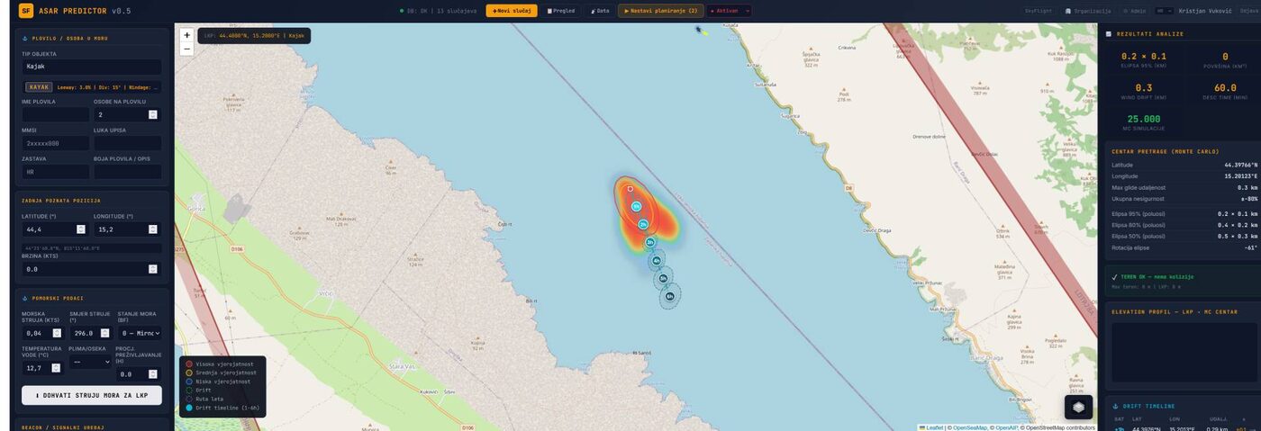
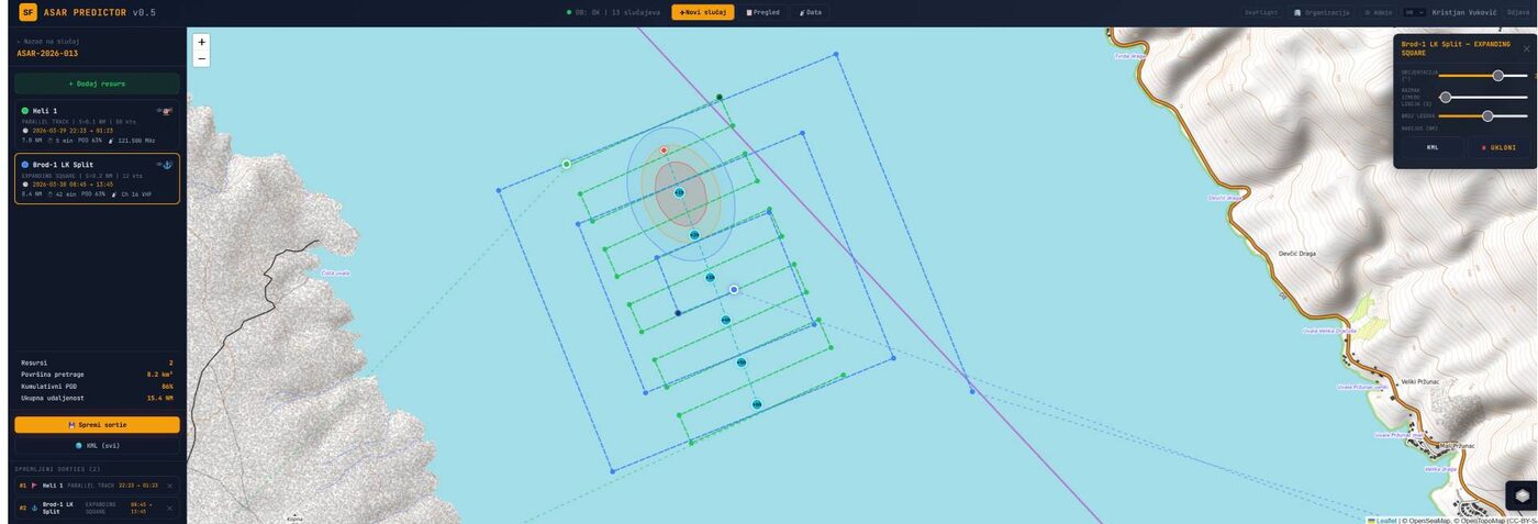
Leeway drift with Copernicus sea currents and wind. Position prediction after 1, 3, 6 and 12 hours, MRCC coordination.
 LAND
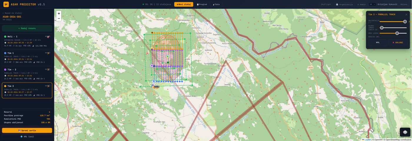
Koester statistics, 50/75/95 % probability zones, sectors, tasks and GPS tracking of teams.
 FLOOD
Levee breach simulation, barrier placement, evacuation routes and spread prediction.
 FIRE
NASA FIRMS hot spots, spread prediction, firebreaks and satellite overview of the burnt area.
 CBRN
ATP-45 contamination plume prediction, ERG database with 125 substances, 12, 24 and 48 hour projection.
 EQ
EMSC monitoring, damage zones by magnitude, satellite before-and-after view.
 UAV
Fleet, pilots and altitudes in real time. One ACO manages all aircraft.
 NOTAM
Airspace reservation without guessing which request to send. The module drafts the correct request to air traffic control. Also available on its own.
 BEACON
Processing of 406 MHz beacon signals: HEX ID, registration data and position as the starting point of the search.
You buy only the modules you need and scale to the real needs of your organisation. ASAR is available in the cloud or as an on-premise installation on your own infrastructure, with an SLA maintenance agreement. Everything about ASAR at asar.skyflight.hr
To another institution with its full history, in one click.
After a shift with no loss of context: everything that was decided, and why, stays in the system.
Built from the operation data, with no retyping afterwards.
With time and author, so a wrong entry does not disappear: it is corrected and visible.
Sentinel-1 and Sentinel-2, NASA FIRMS and Copernicus in the system. ASAR drafts the ERCC request for imagery of the affected area for you, in one click.
Add your own API key and switch on AI mode when you need it. AI suggests next steps, and reports and outgoing replies follow your standard text protocol, so reporting is faster and consistent.
Drone platform
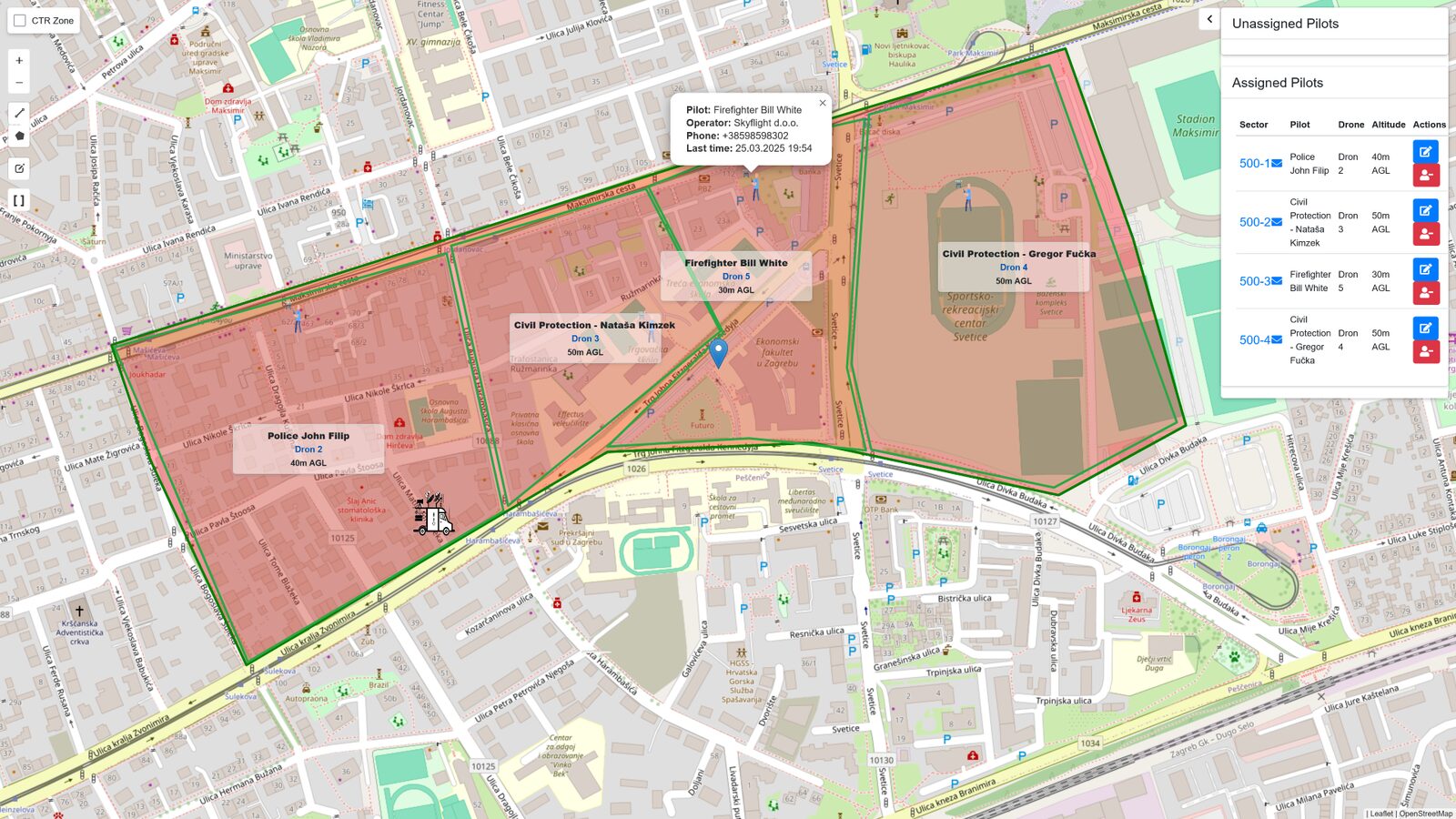
We built the platform inside the emergency services, for the emergency services. Several organisations fly in the same zone with assigned sectors and altitudes, and the coordinator sees every pilot on the map. It has been in production for more than two years.
Platform
Around ASAR are the tools that bring data in from the field and send tasks back to the people who carry them out: the Drone platform, ASAR Mobile, the TAK server and the media server. Each part works on its own, and everything flows onto the coordinator’s single screen.
Prediction, planning and coordination of every crisis. Ten modules, satellite imagery, AI reports, audit log and multi-organisation work on the same incident.
Web for the aircraft coordinator (ACO) and a mobile app for pilots. Sectors, altitudes, licences and fleet.
App for field teams: task, sector, navigation, photos and status back to the coordinator. Compatible with ATAK-CIV.
The bridge between the field and the centre. Both mobile apps talk to the TAK server, and it talks to ASAR. The server already runs on our infrastructure.
Live video from drones and the field to the coordinator and superiors.
Bilateral cooperation without digging through drawers: a register of agreements, the obligations they carry and step-by-step SOPs, digital and semi-automated. What CECIS is for the EU mechanism, BECIS is for bilateral agreements.
The system is delivered tailored to the organisation: the selected modules, cloud or on-premise installation, setup, training for coordinators and field teams, and maintenance under an SLA agreement. Details are agreed at the demo.
In the field
The pilot and the field team each have their own app. Both work with the TAK server, so the coordinator in ASAR sees everything on the same map.
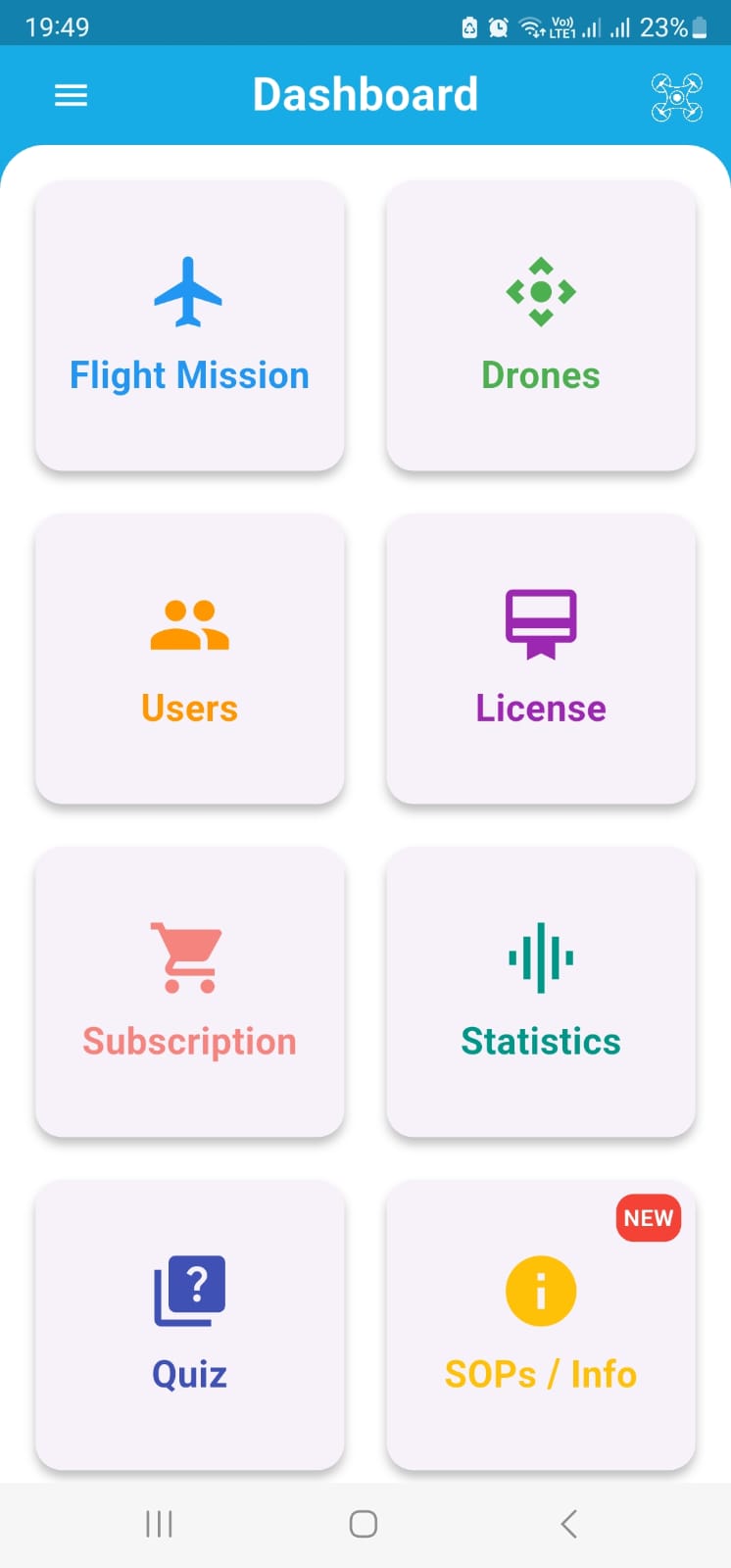
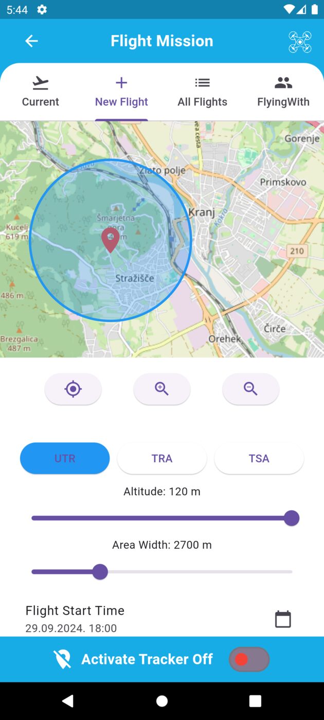
Assigned sector and altitude, flight zone, documents and licences, weather and flight log. Available on Google Play.
Google PlayTask, sector and navigation in the app. GPS tracking, photos and status in real time. Compatible with ATAK-CIV. Distributed to organisations together with the system.
Contact
We tailor the demo to your organisation: 112 centres, civil protection, mountain rescue, MRCC, fire services, police, armed forces and drone operators. We show you ASAR on a real scenario from your area.
Other projects
We have been building software since 2006, from web shops to crisis coordination systems. Alongside the emergency services we also work for retail, healthcare and security.